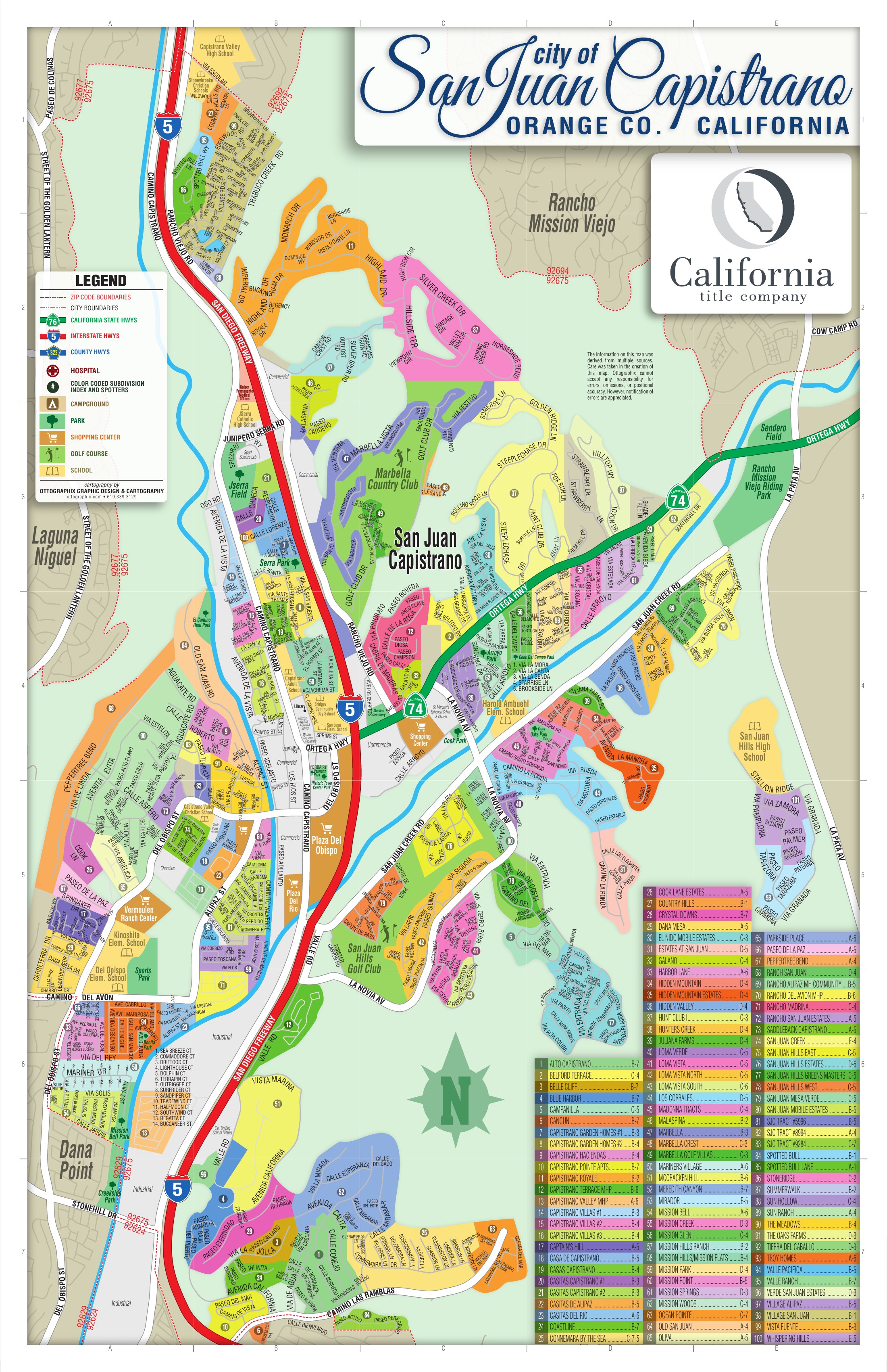
San Juan Capistrano sits inland of Dana Point and Capistrano Beach, north of San Clemente, south of Mission Viejo and Laguna Niguel, and west of the open land that becomes Rancho Mission Viejo and eventually Riverside County. It is not a beach city, but its southwestern edge is close enough to the coast that elevation and marine orientation become real pricing variables.
The city is physically organized by a short list of corridors, and an agent who knows them can place almost any property in seconds.
Interstate 5 runs north and south through the city. It is the primary transportation corridor, a physical divider, a noise and air-quality consideration for nearby property, and the practical line between the more coastal-facing western geography and the eastern foothill markets.
Ortega Highway (SR-74) runs east and west. It organizes the lower Ortega estate market, the Hunt Club corridor, the private-school geography, the upper Ortega foothill communities, and the connection toward Rancho Mission Viejo.
Del Obispo Street and Alipaz organize the flatter valley floor: agricultural history, The Farm, several attached and manufactured-home communities, and the route toward Dana Point.
San Juan Creek Road and Valle Road organize the San Juan Hills market, the golf-oriented housing and the central foothill product.
Camino Capistrano and the rail corridor organize downtown, the historic core, the northern industrial and attached-housing corridor, and several older residential communities.
Also worth knowing by name: La Novia Avenue, Rancho Viejo Road, Junipero Serra Road, Camino del Avion, Valle Road, Camino Las Ramblas, La Pata Avenue and Antonio Parkway. San Juan Creek and Trabuco Creek are the two major watercourses, and both shape both development pattern and diligence.
The right geographic question is not "where in San Juan Capistrano is this property?" It is "which geographic system is this property part of?"